Skip to content

Satellite evidence
of a parcel's history

TerraScane is a platform for analyzing a parcel with satellite imagery from 1984 to today and getting the results as a report. Every map in the report carries its source and date.

Start a pilot
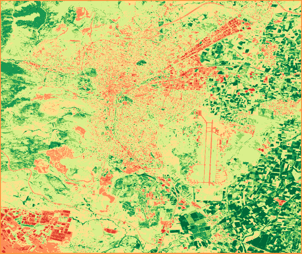
NDVI map of Balıkesir-Merkez, July 2026; vegetation density classified from red to dark green.

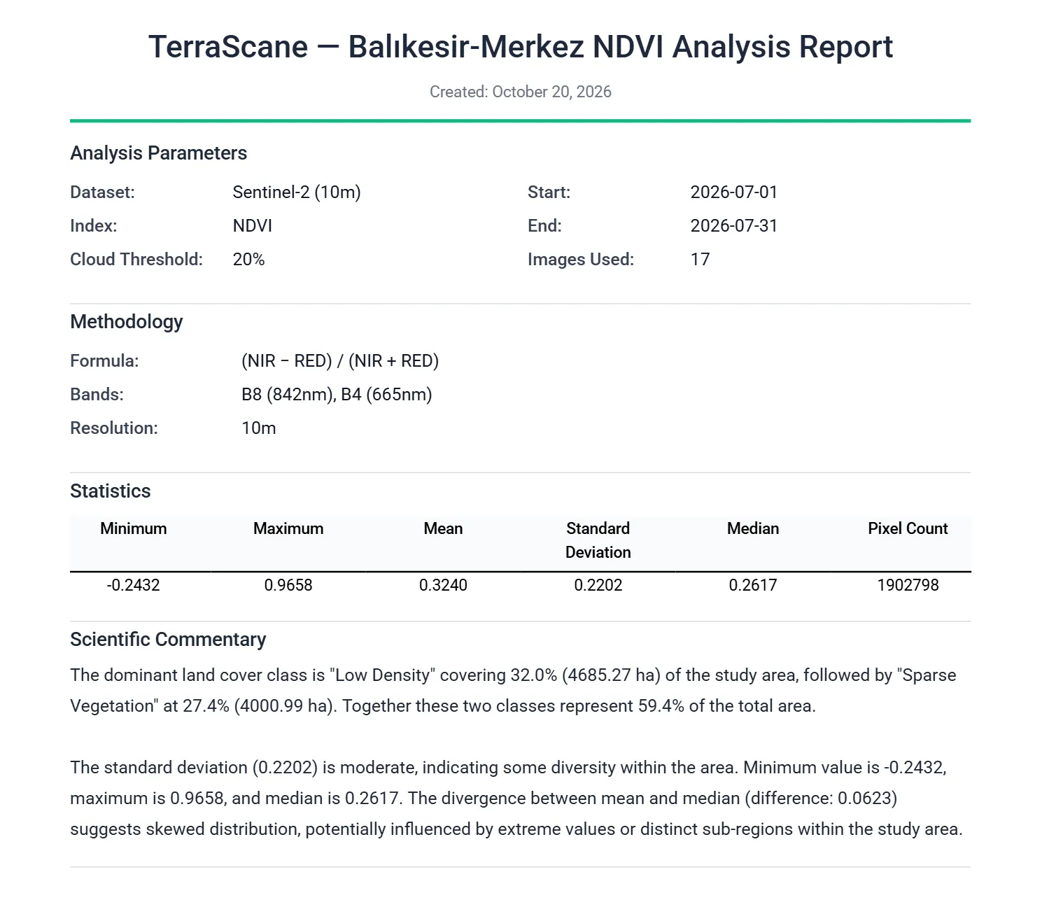
NDVI, single period · Sentinel-2 (10 m) · July 1-31, 2026 · Balıkesir-Merkez · 17 images

  • Water Bodies-1 to 0
  • Bare Soil0 to 0.1
  • Sparse Vegetation0.1 to 0.2
  • Low Density0.2 to 0.4
  • Medium Density0.4 to 0.6
  • Dense Vegetation0.6 to 0.8
  • Very Dense Vegetation0.8 to 1

Contains modified Copernicus Sentinel data 2026

Two ways to work with us

We do it for you

We take your parcel file and agree on the period with you. Depending on the service, we deliver the results as a PDF report, an Excel spreadsheet, or a Google Earth file, in Turkish, English, or both. Preparation takes weeks instead of months.

Start a pilot
Contains modified Copernicus Sentinel data 2026

Do it yourself

The satellite image analysis platform opens in your browser and needs no installation. Without signing up, you can run 5 analyses on 2 parcels of up to 7,500 hectares each. The analyses use 13 spectral indices and the Landsat archive back to 1984. For packages and account quotas, write to us through the contact page.

Explore the platform

Seven analysis types on the platform

Each type answers a different question about the parcel and produces its own files.

Single analysis examines a parcel with one index over the period you choose.

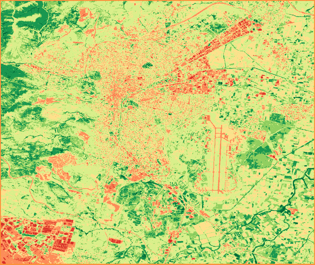
Classified NDVI map of Balıkesir-Merkez, July 2026: the city center in orange and yellow, building blocks in the southwest and northeast in red, farm parcels in the east and slopes in the west in shades of green.

NDVI, single period · Sentinel-2 (10 m) · July 1-31, 2026 · Balıkesir-Merkez · 17 images

  • Water Bodies-1 to 0
  • Bare Soil0 to 0.1
  • Sparse Vegetation0.1 to 0.2
  • Low Density0.2 to 0.4
  • Medium Density0.4 to 0.6
  • Dense Vegetation0.6 to 0.8
  • Very Dense Vegetation0.8 to 1

Contains modified Copernicus Sentinel data 2026

Analysis types

Datasets

Satellite and elevation data used in the analyses

Turnaround time

With a system we built ourselves, we cut file and report preparation from months to weeks, even days.

Start a pilot