
A satellite image analysis platform that runs in your browser
The TerraScane platform uses satellite imagery to analyze a parcel you draw on the map or upload from a file, and gives you the result as a report. You define the parcel and choose the dataset and period; you download the result as PDF, Excel, KMZ, and GeoTIFF.
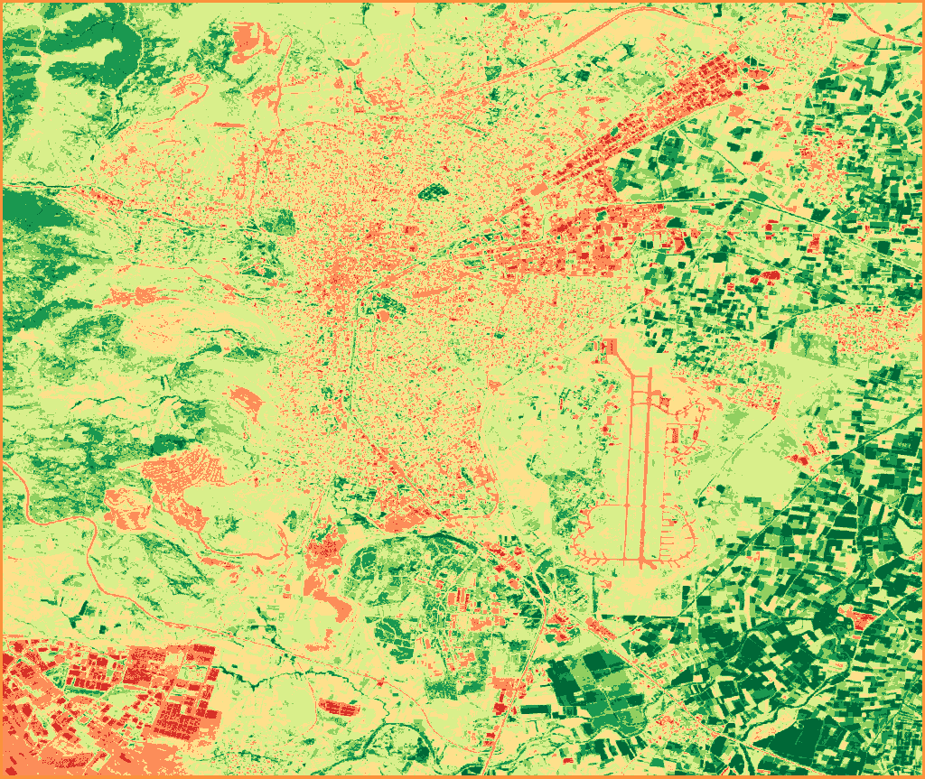
NDVI classes
- Water Bodies-1 to 0
- Bare Soil0 to 0.1
- Sparse Vegetation0.1 to 0.2
- Low Density0.2 to 0.4
- Medium Density0.4 to 0.6
- Dense Vegetation0.6 to 0.8
- Very Dense Vegetation0.8 to 1
NDVI, single period · Sentinel-2 (10 m) · July 1-31, 2026 · Balıkesir-Merkez · 17 images
Contains modified Copernicus Sentinel data 2026
- Parcel area
- 0.1 to 100,000 ha
- Upload
- KML, KMZ, GeoJSON, or ZIP
- Analysis types
- Single, Topographic, Delta, Comparison, Batch, Land Cover, and Urban Heat Island
- Indices
- 13 spectral indices and surface temperature
- Outputs
- PDF, Excel, KMZ, and GeoTIFF
- Report language
- Turkish or English
Analysis in four steps
Draw the parcel or upload a file
You draw the parcel on the map or upload it from a file: KML, KMZ, GeoJSON, or ZIP.
Choose the data and period
You set the analysis type, dataset, index, date range, and cloud threshold.
Start the analysis
The platform sorts the pixels in the parcel into classes by index value and calculates the area of each class in hectares and as a percentage.
Download the report
You download the result as a PDF report in Turkish or English, an Excel spreadsheet, a KMZ, and a GeoTIFF. Each report carries the data, method, threshold, and literature reference it was produced with.
You can find the details of each type on the analysis types page, the formulas on the indices page, and the satellites' resolution and date ranges on the satellite data page.
Trial and limits
You can try the platform without signing up: you run 5 analyses on 2 parcels of up to 7,500 hectares each. For file upload, downloads, and the Batch and Land Cover modes, a free account is all you need. For account quotas and packages, write to us through the contact page.
| Limit | Value |
|---|---|
| Parcel area | 0.1 to 100,000 ha |
| Vertices on the parcel boundary | Up to 500 |
| Size of the uploaded file | Up to 10 MB |
| Polygons in one file | Up to 50 |
Sample outputs
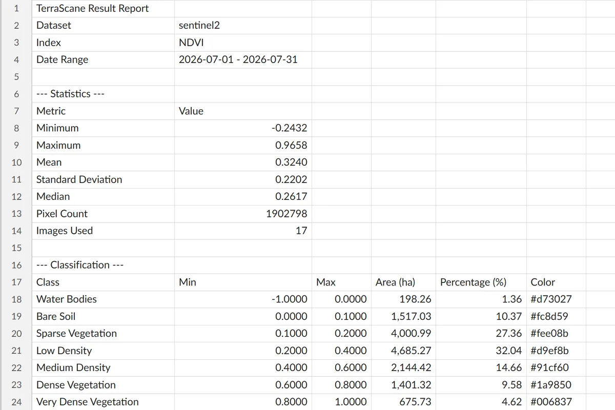
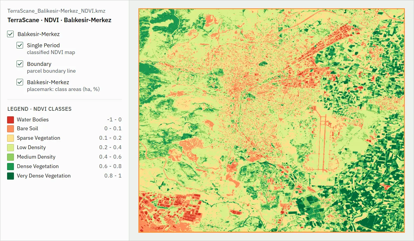
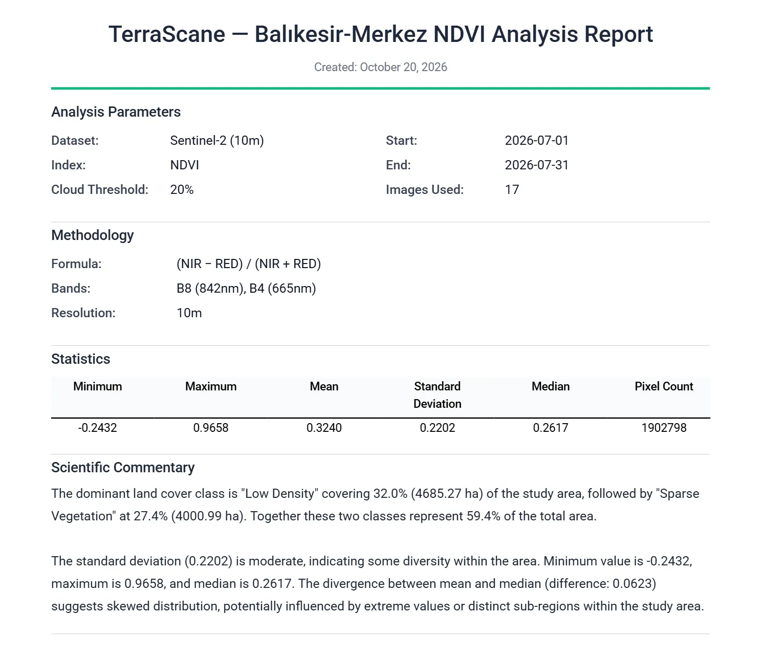
The images come from the files of a Single NDVI analysis of Balıkesir-Merkez for July 1-31, 2026, made with Sentinel-2 data. You can find what each of the four formats contains on the outputs page.
Contains modified Copernicus Sentinel data 2026
How can I try the platform?
With the "Try the platform" button, you can open a trial session without signing up. In this session, you can draw 2 parcels of up to 7,500 ha each and run 5 analyses in total. File upload, downloads, and the Batch and Land Cover modes are available with a free account.
Which file formats can I upload?
KML, KMZ, GeoJSON (.geojson or .json), and ZIP. You upload a shapefile as a single ZIP that holds its .shp, .shx, .dbf, and .prj files; the ZIP can also contain KML, KMZ, or GeoJSON. A file can be up to 10 MB and contain up to 50 polygons.
Which satellite data does the platform use?
Sentinel-2 (10 m, from 2017); Landsat 5, 7, 8, and 9 (30 m, with the archive going back to 1984); and, in Single analysis, MODIS (1,000 m, NDVI and EVI). Slope and aspect are calculated from the Copernicus GLO-30 elevation model.
Which languages are the reports in?
Turkish and English. You can download the PDF report of the same analysis in both languages. In Batch analysis, you choose Turkish, English, or both as the report language; if you choose both, each parcel's report is produced in both languages.
Where are the calculations done?
On a cloud-based satellite processing infrastructure. Image selection and index calculation happen there; you define the parcel and start the analysis in your browser.
Two ways to work with us
Without signing up, you can run 5 analyses on 2 parcels of up to 7,500 hectares each. If you would like us to run the analysis, let's start with a pilot on a single parcel.
Other platform pages
Outputs
PDF report, Excel spreadsheet, KMZ that opens in Google Earth, and GeoTIFF.
View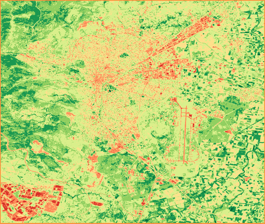
Satellite data
Sentinel-2; Landsat 5, 7, 8, and 9; MODIS; and Copernicus DEM.
View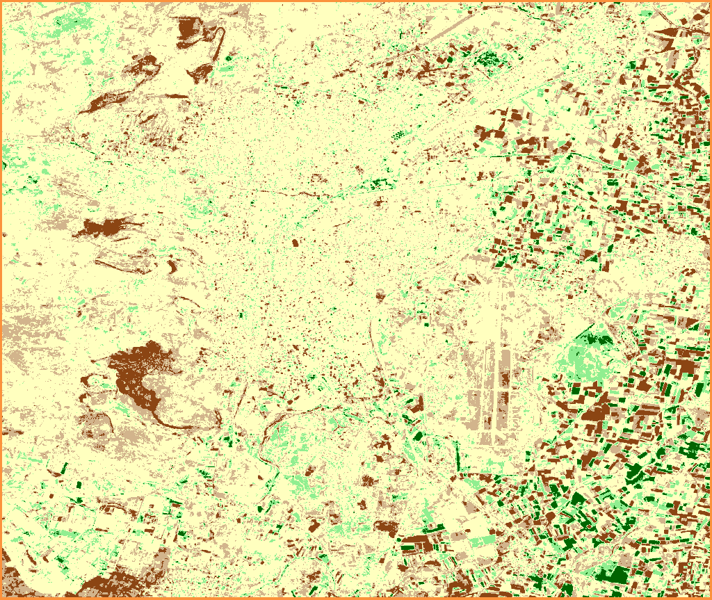
Analysis types
Single, Topographic, Delta, Comparison, Batch, Land Cover, and Urban Heat Island analyses.
ViewIndices
All 13 spectral indices, NDVI included, with their formulas and bands.
View
Contains modified Copernicus Sentinel data 2020, 2026